
To More Inquiry

Today we will meet at Puerto Ordaz Airport, and from there we will start our ground journey to the south and through the Gran Sabana. We will stay today in the indigenous village called San Francisco de Yuruani at Kumaracapay Lodge. This night we will have a briefing of the trekking with the guide. (B,L,D) Driving duration: 10 hours
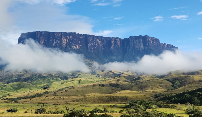
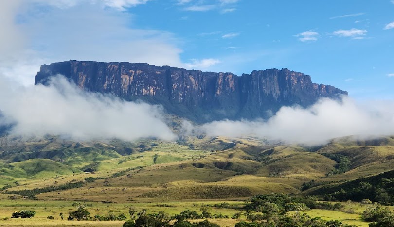
After a succulent and typical breakfast, we will board a 4WD vehicle. Nearly the entire region, or almost 7.4 million acres including the mountainous areas to the west, has been set aside as Canaima National Park to protect the special ecology of this land of tepuyes, waterfalls, and exotic flora and fauna. It is the sixth largest national park on earth! We'll turn off of the main highway and drive over a dirt road to Indian community of Parai-tepui. We begin trekking, followed by our porters who prefer to use their own backpack-like woven baskets to carry their loads. Directly ahead of us is the massive, symmetrical bulk of Mount Roraima, whose 2800 m summit towers above the plains. We arrive to our campsite on Tek River. (B, L, D) Drive duration: 2 Hrs Trek length: 12 kms. Trek duration: 5 hours hiking Camp elevation: 1050 m.
This morning we head out and after 30 minutes, we encounter and cross the Kukenam River. We follow the long incline that leads gradually uphill to the base of Roraima's vertical, 2,000 foot cliffs. The terrain is a series of long ridges radiating out from the main mountain and is covered by grasslands except in deep ravines where rainforest patches have escaped the local Indians' fires. About halfway to our basecamp, we enter a broad sloping area where we might spot Tropidurus lizards scurrying across the trail, watch chestnut-collared parrots hopping in the shrubs, or observe yellow-headed vultures circling overhead. Our basecamp is located at the foot of Roraima's spectacular walls. Here we have breathtaking views of the savannah rolling away into the distance as well as the splendid rose-colored cliffs rising straight up above us toward the mountain's flat summit. In the late afternoon we can enjoy excellent photographic opportunities as we watch the interplay of mists and sunlight across the mountain's top until the sun sets. Trek length: 6 kms. Trek duration: 4 hours hiking Camp elevation: 1870 m. (B, L, D)
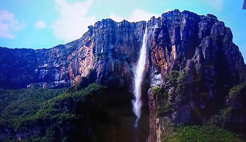
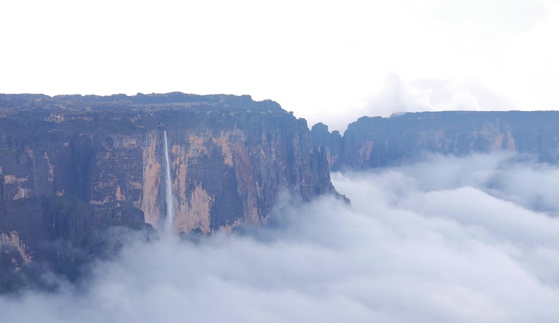
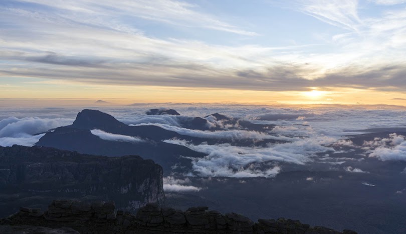
Our ascent today follows a natural ledge which runs from right to left along the cliff face, allowing the only non-technical access to the summit of Roraima. This route, discovered by the British explorer, Everard Im Thurn in 1884, passes through steep, jungle-like terrain that requires good stamina but no climbing skills. Just beyond our camp, we cross a stream and enter into an exquisite cloud-forest where the dense vegetation prevents us from seeing the cliffs ahead other savannah dropping away behind. Our concentration is focused on the trail and the diverse plants around us. Bromeliads, bladderworts, sundews, fern trees, mosses and heliconias are everywhere. Continuing through the cloud-forest that envelopes the cliffs, the trail is wide enough to be safe but is steep and can be very slippery in some places. Orchids, ferns, palms, woody shrubs, and lovely flowers abound. There are three sections where we have to scramble down and up again through small ravines, and the last has the surprise of a thin, ribbon-like waterfall plunging from the crest that splashes the trail with droplets (it really flows when it is raining on the summit). Near the top, our route gets steeper and rockier. It then turns inward through a natural cleft in the rock and suddenly we are on the summit gazing at the strange, fascinating landscape. From the edge of the plateau we continue crossing alternating patches of dry, black rock and wet, peat bogs until we arrive to our camp in the early afternoon. Our tents are pitched in natural caves, providing an added measure of protection from the frequent mists and showers on top. Following lunch, we begin our initial explorations of the tepuy mysterious and often foggy summit. Trek length: 4.5 Kms. Trek duration: 5 hours hiking Camp elevation: 2700 m. (B, L, D)
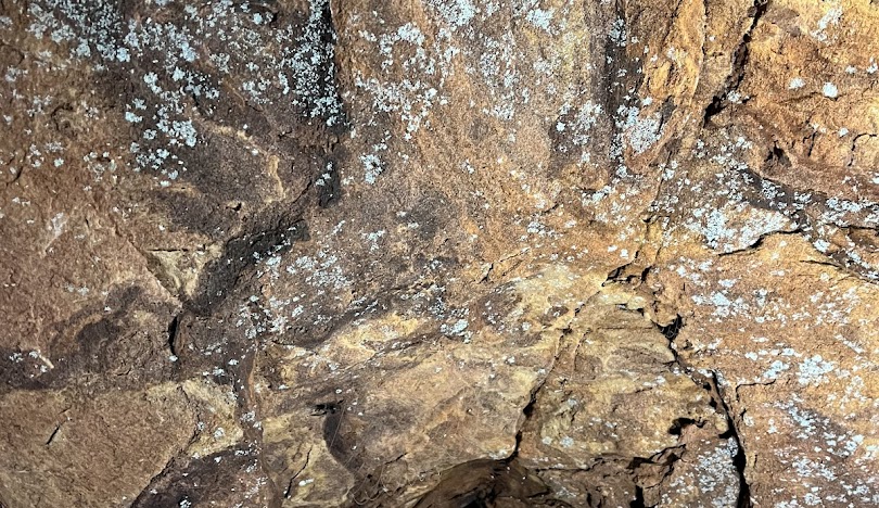
We have the full day today to explore the fantasy land atop Roraima whose massive summit is 30 miles long and 12½ miles wide! The eroding forces of constant wind and rain have formed giant, stone sculptures; house-sized slabs balanced precariously on slender spires; the arches and pillars of a forgotten, imaginary dynasty; and natural bridges that span narrow chasms. The dominant color is black, created by the rock encrusting lichen that covers every bare surface in all directions. Depending on weather and group conditions, the strongest walkers may follow a rough trail through this bizarre landscape, hiking up and down, crossing creeks and boggy terrain, passing through natural labyrinths, and weaving among boulders to arrive to the concrete monument marking the "triple-point" where the countries of Venezuela, Brazil, and Guyana meet. We have lunch here. As we walk back to camp, we observe several interesting species of plants such as the Stegolepis guianensis, Orectanthe sceptrum, Drosera roraimae (a type of sundew) and Heliamphora nutans (a native sun pitcher) plus lots of ferns, mosses, orchids, and bromeliads. Roughly half of the flora identified in the "Lost World" exists on Roraima and nowhere else in the world. We might also see the tiny pebble toad who rolls downhill to escape from danger. We arrive to our camp in the late afternoon, tired from the long hike but excited by our amazing discoveries during this day of exploring the Mother of Streams. Soup and a hot dinner are welcomed this evening Trek length: 20 kms Trek duration: 7 hours hiking Camp elevation: 2700 m (B, L, D)
Following breakfast at camp and last opportunity for taking pictures on top, we begin our descent. Returning to the ledge we work our way carefully back down through the cloud-forest. If the weather permits, the views out across the savannah and back toward Roraima's sheer walls can be incredible. Upon reaching our former basecamp area we enjoy lunch and perhaps take a refreshing dip in the stream below the campsite. We then continue along the more gradual descent to the Kukenán River where we cross the stream and hike one mile further to a campsite at Rio tek. Trek length: 10 Kms. Trek duration: 6 hours hiking Camp elevation: 1050 m. (B, L, D)
Today we leave camp early in order to avoid the strong sunlight and heat of midday as we continue the trek back to our staff's village Paraytepuy. We take final, lingering looks toward Roraima's summit, remembering the bizarre rock formations and unique flora and fauna we discovered there and catching glimpses of the Lost World before the mists envelope the top and hide it from our view. Our route is slightly uphill as the elevation of Perai-tepuy is higher than that of the Rio tek valley, so we really appreciate the cool drinks that await us when we arrive. We say goodbye to our friendly camp staff and, after loading our gear into the vehicles, we're bound for San Francisco de Yuruani where you should have opportunities to purchase some of the intricately woven baskets, backpacks, fishing bows and arrows, and other hand crafted items that are made in the area. Trek length: 12 kms Trek duration: 4 hours hiking Driving duration: 2 hours (B, L, D)
After our last night in the Gran Sabana and a typical breakfast, we board our private van and head to Puerto Ordaz. End of services (B,L,-). Driving duration: 10 hours
Reserve your ideal trip early for a hassle-free trip; secure comfort and convenience!
To receive our best monthly deals





Leave a comment: